
village
Terre-de-Haut
The main island of the Saintes mini-archipelago: Fort Napoléon (1867) with 360° view of the UNESCO bay, Pompierre beach (golden sand, turquoise lagoon), Pain de Sucre (53 m, spectacular view) and Creole village with Mediterranean charm.
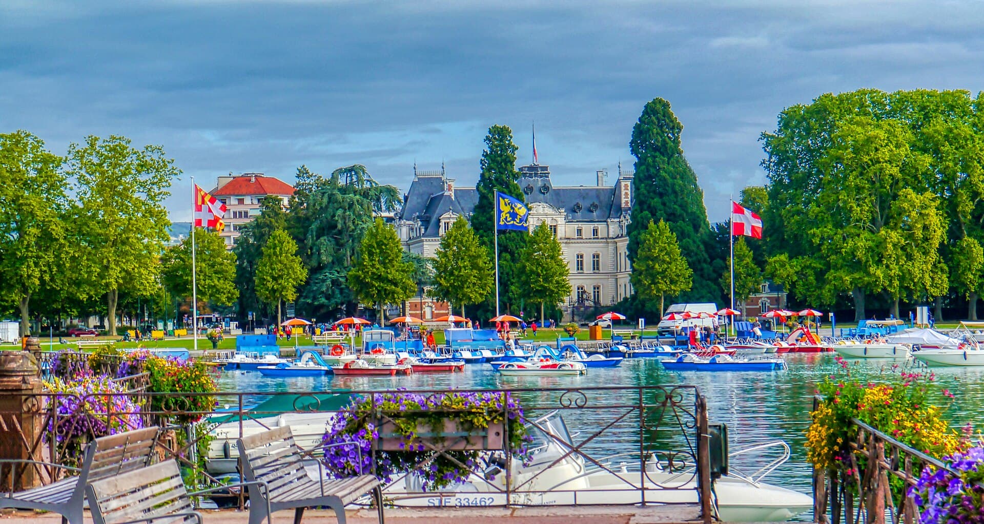
Terre-de-Haut is the most visited of the two inhabited Saintes islands — only 5 km², 1,500 inhabitants, but one of the most spectacular landscapes in the French Antilles. Located 15 km south of Basse-Terre, the island forms with its neighbour Terre-de-Bas and 7 uninhabited islets the Saintes archipelago whose bay is UNESCO-classed among the world's most beautiful bays (since 1998, alongside Rio, Halong, San Francisco).
Terre-de-Haut's identity is singular in the Guadeloupean archipelago. The population mainly descends from Breton and Norman sailors settled from the 17th century — poorly adapted to cane cultivation, they turned to fishing, which remains an essential activity today. This European origin explains the village architecture (white houses with blue shutters, red roofs, paved square) which has a deliberate Mediterranean charm surprising for visitors used to more tropical Creole atmospheres. The famous Saintois straw hat (with its characteristic turned-up brim) remains the island's clothing emblem.
The landscape of Terre-de-Haut is dominated by three volcanic peaks: the Fort Napoléon (114 m, north-west, former 19th-century fortress converted into a museum and botanical garden), the Pain de Sucre (53 m, south-west, spectacular rocky dome overlooking Anse Pompierre) and the Chameau (309 m, archipelago's highest point, south-east). Beaches structure the coast: Pompierre Beach (the most iconic, north coast, 600 m of golden sand with view of Pain de Sucre), Anse Crawen (the wildest, south coast, naturism tolerated), Anse Mire and Anse à Cointre (more confidential). No cars are allowed in the village — you'll explore on foot, by bike (rental €10-15/day), scooter (€25-35/day) or collective minibus (taxi-bus, €3-5/journey).
What we love
- ✅Saintes Bay UNESCO-listed among the world's most beautiful — exceptional Caribbean setting
- ✅Fort Napoléon (1867): history museum, exotic botanical garden, 360° panoramic view of the bay
- ✅Pompierre Beach: 600 m of golden sand, shallow turquoise water, view of Pain de Sucre
- ✅Pain de Sucre: 53 m rocky dome, 30 min ascent from Anse Pompierre, spectacular view
- ✅Creole village with unique Mediterranean charm in the Guadeloupean archipelago (Breton/Norman descent)
What to know
- ❌Cruise visitors invade the village between 10 am and 4 pm on call days
- ❌Limited and expensive accommodation, mandatory booking 4-6 months in advance
- ❌No car allowed — travel on foot, bike or scooter only
- ❌Access only by maritime shuttle (cancellations possible in rough seas)
Situation
Où se situe Terre-de-Haut ?
Ouvrir la carte en grand sur OpenStreetMap →Frequently asked questions
How to get to Terre-de-Haut?+
How many days do you need to visit Terre-de-Haut?+
What to see at Fort Napoléon?+
Which is the most beautiful beach in Terre-de-Haut?+
Where to stay in Terre-de-Haut?+
Our verdict
Terre-de-Haut is one of the most beautiful gems of the Lesser Antilles — a stunningly beautiful island whose bay is UNESCO-classed among the world's most beautiful. Fort Napoléon, Pompierre beach, Pain de Sucre and the Mediterranean charm of the village justify the escape on their own. To truly appreciate the island, stay on site at least 2-3 nights — the magic operates especially early in the morning and late in the day, when cruise visitors have left. Hire a scooter to reach Anse Crawen, climb Pain de Sucre at sunrise, watch the sunset from Fort Napoléon, and savour tourments d'amour at the landing place. Combine with Marie-Galante or Basse-Terre for a complete Guadeloupe stay.
Nearby


"Janvier à Terre-de-Haut : conditions parfaites mais croisières fréquentes. Dormez sur place pour profiter de l'île au calme avant 10h et après 16h. Coucher de soleil magique depuis le Fort Napoléon."
Expert on Terre-de-Haut · 1 contributions