Region
Central Martinique
Fort-de-France and Caravelle: the administrative and cultural pole of the island on one side, one of the most beautiful nature reserves of the Antilles on the other — a striking contrast in 30 minutes' drive.
Central Martinique articulates two radically different but complementary universes: on one side, the agglomeration of Fort-de-France, economic, administrative and cultural capital of the island (130,000 inhabitants, more than a third of the Martinican population); on the other, the Caravelle peninsula to the east, one of the most preserved Nature Reserves of the Lesser Antilles. Between the two, less marked but essential spaces: Génipa bay and its coastal mangroves, the heights of Schoelcher with their panorama over Fort-de-France bay, the village of Le Lamentin (around the airport), and the panoramic road leading to Tartane.
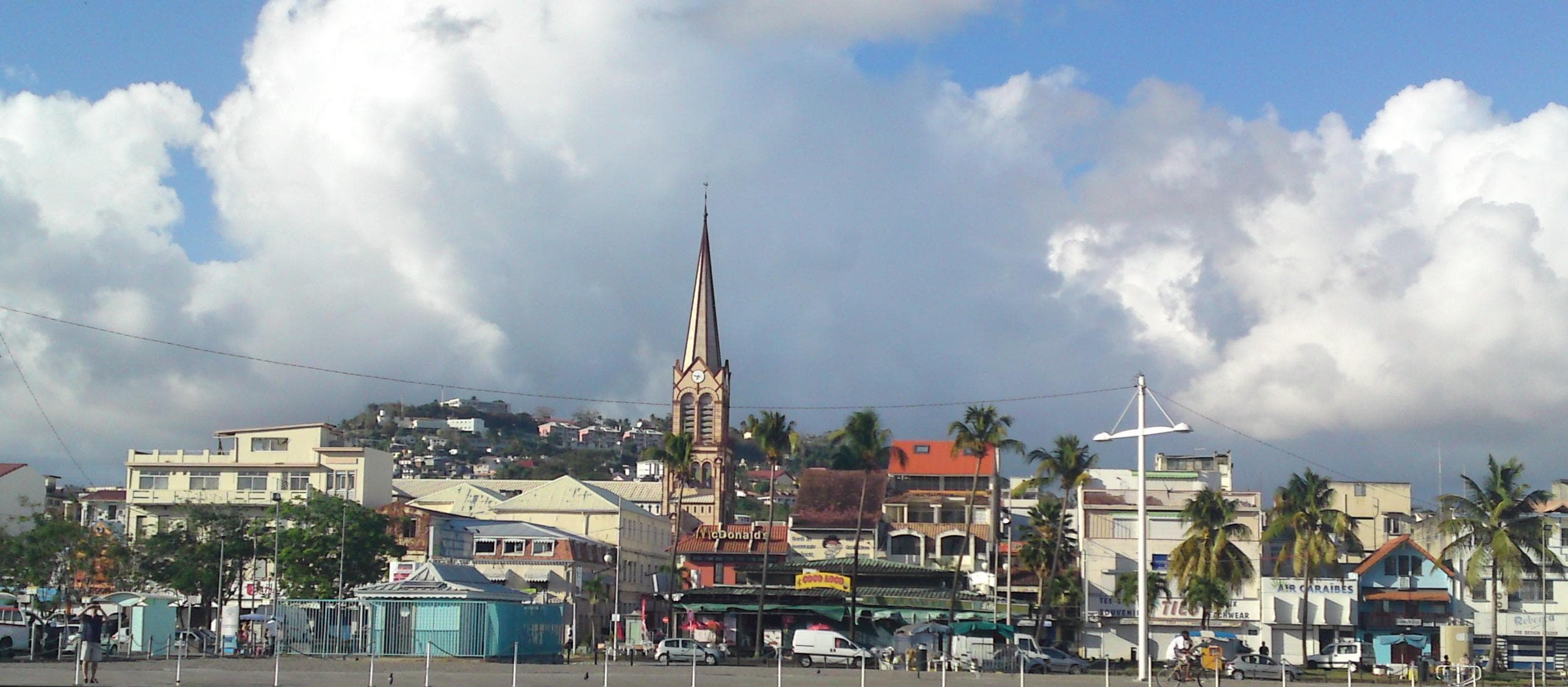
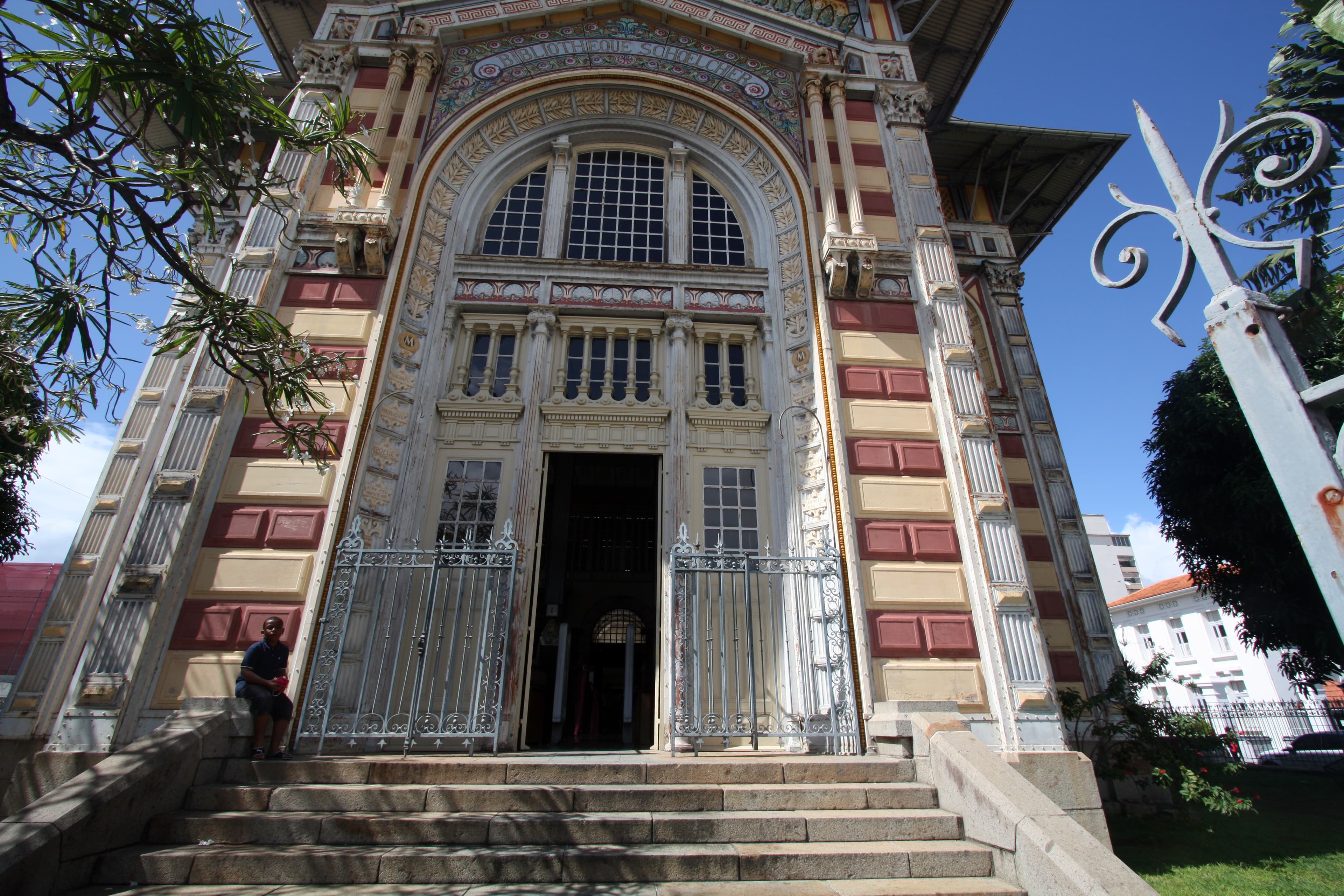
Fort-de-France is discovered on foot in a day. The historic heart organises around La Savane, vast shaded esplanade bordered by royal palms, where the statue of Aimé Césaire and the Schoelcher Library (1893) stand — an architectural masterpiece in prefabricated metal transported from Paris for the 1889 Universal Exhibition, unique in the Caribbean. The Fort Saint-Louis (17th century, Vauban fortification still in military activity) closes La Savane on the sea side. The Saint-Louis Cathedral (1895), with its characteristic metal spire, dominates the city centre. The covered market (Grand Marché de Fort-de-France) is the commercial and social soul of the city: Creole spices, tropical fruits, arranged rums, madras fabrics, basketry. Two steps away, the fish market gathers morning fishermen with their fresh catches.
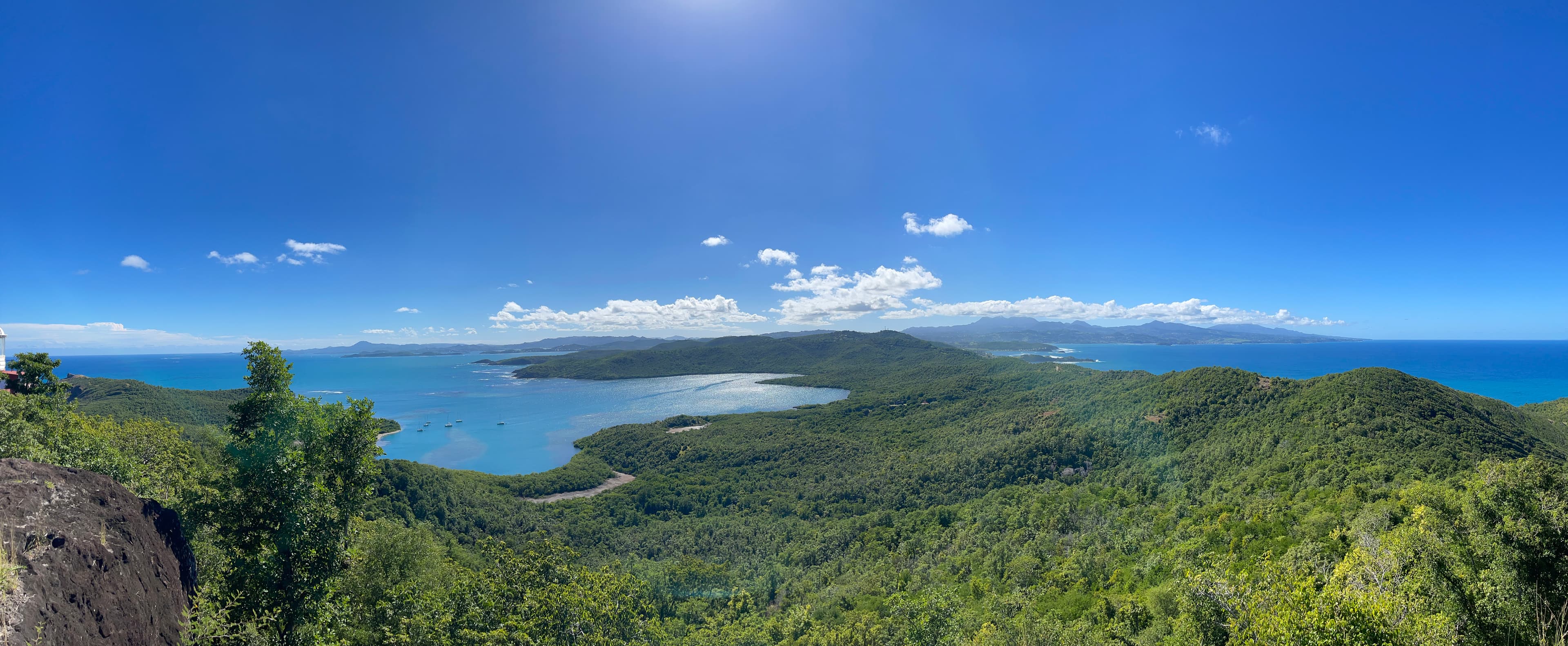
The Caravelle peninsula, 40 minutes east by road, is a strip of land 12 km long advancing into the Atlantic. The Nature Reserve covers the eastern half of the peninsula and offers one of the most emblematic hiking trails of the island: the Château Dubuc circuit (8 km, 3-4h, moderate elevation) combining ruins of an 18th-century sugar habitation, dry tropical forest, mangrove of mangroves, Atlantic cliffs and confidential beaches. The village of Tartane, at the entrance of the peninsula, has become a popular spot for surfers (constant Atlantic waves) and houses some good Creole addresses. The Anse l'Étang beach and the Surfers' beach are the main swimming beaches.
Explore Central Martinique
Spots in the region
Situation
Où se situe Central Martinique ?
Ouvrir la carte en grand sur OpenStreetMap →Frequently asked questions
Should I sleep in Fort-de-France?+
How many days do you need for the Centre?+
How to avoid crowds in Fort-de-France?+
Is the Caravelle trail difficult?+
What must you absolutely see in Fort-de-France?+
Can you visit the Génipa bay mangroves?+
Which day to visit the Fort-de-France market?+
Our verdict
Central Martinique is the region to integrate for those who want to understand the island in depth — beyond the seaside postcard of the South. Plan a minimum of 2 days on the Centre: a Fort-de-France day (Savane, Fort Saint-Louis, covered market, Schoelcher Library, Creole lunch) and a Caravelle day (8 km trail, swimming at Anse l'Étang, lunch in Tartane). Do not necessarily sleep in Fort-de-France (limited and not very glamorous hotel offer): prefer a base in the South or North, and come on day excursion. The ideal period is the carême, avoiding days of massive cruise stopovers (consult the official calendar of Fort-de-France marina).