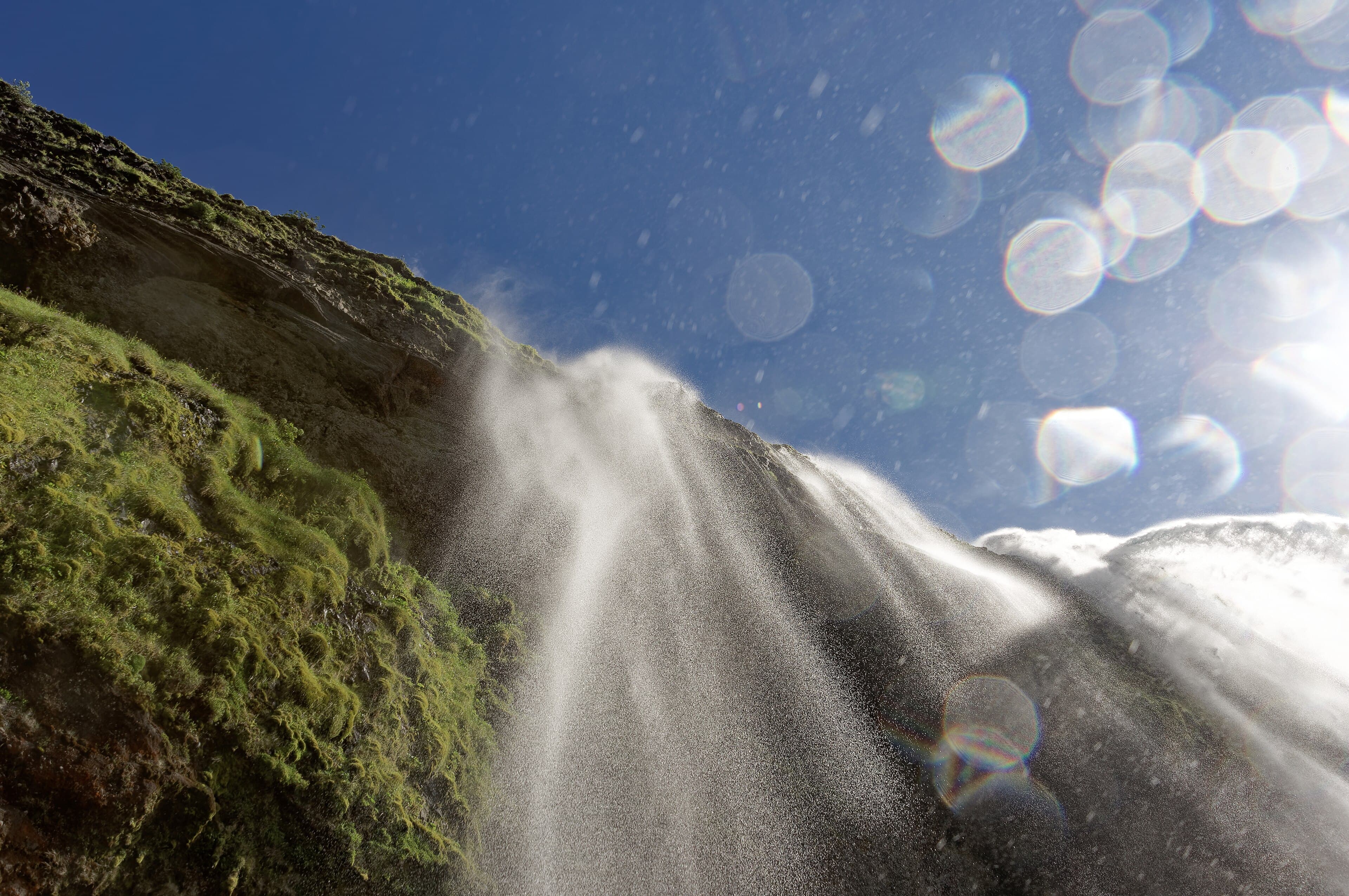
Seljalandsfoss (130 km from Reykjavik, Route 1 + Route 249) takes 1 hour. Park at the paid car park (ISK 700 / €4.50), take the path that circles behind the waterfall (200 m circular, accessible year-round but often muddy and wet — waterproof essential, and waterproof bag for camera gear). 600 m to the north, don't miss Gljúfrabúi, a hidden waterfall in a rock fissure you discover by walking through a stream (wet feet guaranteed, magical).
Skógafoss (30 km east of Seljalandsfoss) takes 30-60 minutes. Park at the free car park, photograph the waterfall from the base (60 m drop, 25 m wide, perfectly rectangular wall of water, rainbows on sunny days), then climb the 527-step staircase on the side for a panoramic view from the top. For experienced hikers, the Fimmvörðuháls trail continues from Skógafoss for 25 km through the highlands to Þórsmörk (8-12 h, accessible mid-June to late August).
The Sólheimajökull glacier (a Mýrdalsjökull tongue, accessible by Route 221 5 km north of Route 1) takes at least half a day. The viewpoint from the car park (free, 200 m walk) is already spectacular. To walk on the ice, book a guided glacier hike (€90-150/person, 3-4 h, equipment provided — crampons + ice axe, departure from the car park or Skógar, operators Arctic Adventures, Icelandic Mountain Guides, Glacier Guides).
Dyrhólaey (peninsula 5 km west of Vík, accessible by Route 218) is one of the best puffin observation points between May and early August. The summit (120 m altitude) offers an exceptional panorama over Reynisfjara beach, the Dyrhóláey rock arch and the Mýrdalsjökull glacier. The site is free but access roads can be closed in winter.
Reynisfjara (5 km west of Vík, accessible by Route 215) is one of Iceland's most famous beaches. Park at the free car park, walk 100 m to the beach, photograph the basalt columns and the Reynisdrangar stacks. Sneaker wave warning: never go down on the wet sand, never turn your back to the ocean, stay more than 30 m from the edge. The Hálsanefshellir cave (on the right as you arrive on the beach) houses the finest basalt columns.
Jökulsárlón (200 km east of Vík and 80 km west of Höfn) is the south coast's climax. Park at the free car park (north side of Route 1, next to the café-restaurant), photograph the lagoon from the viewpoint, then book an amphibious zodiac tour (€60-90/person, 45 min, May to October only) to navigate between icebergs. Then cross the bridge on foot to the Diamond Beach (south side) to photograph iceberg fragments stranded on the black sand in the sun. Allow 2-3 hours minimum at Jökulsárlón. For the iconic photo at sunrise or sunset without crowds, stay at Hof, Hali or Höfn.
Read also
- Jökulsárlón, glacial lagoon — Iceland's most famous lagoon: floating icebergs, Diamond Beach and zodiac tours.
- Seljalandsfoss, the waterfall you walk behind — 60 m drop you can walk behind via a wet trail — an unforgettable experience.
- Vík and the black Reynisfjara beach — Black volcanic sand beach with sea stacks and a basalt-columned cave.
- The Golden Circle — The Þingvellir-Geysir-Gullfoss loop, the natural complement before the south coast.